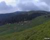
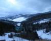
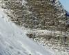
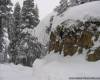
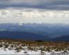
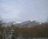
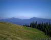
The geological point territory Yaremchanskoy City Council refers to folded Carpathians. Advanced character building - a consequence of the Carpathian folding phase, which took place in three stages: a) Oligocene and Miocene boundary, b) in late Tortona in) on average Pliocene. In these limits onto two structural-facial units: Skybkova and Montenegrin. The geological structure dominated by chalky-Palaeogene flysch. The western part of the territory is situated within Gorgan, characterized by asymmetrical steep slopes and sharp ridges of the mountains. At their peaks centered stone osypyscha, mainly represented by sandstones. The average heights ranging from 400 to 1542 meters. Eastern part of the territory occupied Pokuts'ka-Bukovina Carpathians, which are a system of parallel ridges separated by river valleys Pruttsya Chemehovskoho, Pihy. Absolute height somewhat lower than in Gorgan (highest point - 1325 m). The southern part of the territory is located within the northern slopes Chornogory - the highest mountain massif of Ukrainian Carpathians. Montenegro composed mainly of flysch, deeply dissected slopes of the massif at the top of Alpine expressed relief with the ice forms (the only place in Ukraine). Common stone osypyscha. The main river artery in the City Council is the Prut river, the sources of which are located on the northern slopes Chornogory above an altitude of 1750 m. This area Prut meridional flows is the boundary between Gorgan and Pokuts'ka-Bucovina Carpathians. Deep river valley. It sometimes extends near the exits of soft shale rocks, forming a very large basin (Vorokhta, Mykulychynske et al.), Sometimes narrowed at the intersection zone sandstone. Steep slopes of the valley. Lay a large and flowing river of high speed (1,5-3 m / s). Rocky riverbed and hollow, often occurring waterfalls (the biggest - Yaremchanskiy cascade). Stik Rod quite large. In Yaremche average perennial flow of 13.7 m3 / s, and most - 22.9 m3/sek.Osnovnymy left tributaries Rod is Prutets Yablunyts'kyi (16 km), Zhonka, the heater; right - Piha (11 km), Prutets Chemegivs'kyi (21 km). Over 60% of the territory occupied by forests, mainly beech and fir-spruce, and above 1100-1200 m - spruce. Beech forests with admixture of maple, ash, elm, fir and spruce spread on slopes up to 500-600 m.Zahalna agricultural land area is 6949 hectares, representing 10.7% terytoriyi.Struktura land fund is as follows: arable land - 664 ha, hayfields - 3278 hectares, pastures - 2773 hectares, perennial plants - 234 ha. This structure is explained by land mountain relief with a predominance of steep slopes, dominated by forests of different breed composition and scanty and thin soils. Hayfields and pastures are located mainly on mountain slopes and on their tops (meadows). In the valleys are arable. The largest tracts of arable land are located in Mykulychynske, Vorokhta Tatarovskogo hollows and Rod. Provision of agricultural lands in the municipality is much lower than in the Ivano-Frankivsk and Ukraine in general. These indicators are: Yaremche on 0.3 hectares per person, including arable lands - 0,03 hectares, while in Ivano-Frankivsk region, respectively, 0,5 ha / ha and 0,3 ha / person, by Ukraine - 0,9 ha / ha and 0,6 ha / person. In this area are three common types of soil - brown mountain-forest (brown), mountain-meadow and greensward brownsoil and meadow. Burozems common in well-drained bedrock that are elyuviy diluvium-Carpathian flysch within the forest zone to a height of 1500-1550 m. This is the main type of soils used for farming in the area. Greensward and meadow soils common in the floodplain and within the first two terraces nadzaplavnyh Prut and its tributaries. This area is intensively used for agriculture. The area is characterized by the municipality wealth and variety of flora and fauna, many of which are unique. Here there are 46 species of mammals (bear, wolf, lynx, fox, wild cat, Reaklimatyzovani zubry.dykyy boar, deer European), 180 species of birds, many reptiles, amphibians, fish.