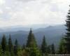
Visit these fabulous place every traveler should really interested in Ukraine. It is here - in the heart of Europe - is a beautiful country with beautiful Carpathian highlanders ranges, valleys and amazing residents who appreciate the opportunity presented to them the fate of living a full life in communion with nature. Thread of the most popular mountain route of Ukraine lies in the valleys and mountains Gutsulschiny which stretches Montenegrin Mountains - the highest mountain massif of Ukrainian Carpathians, where the six peaks, which exceed the height of 2000 meters.
The upper part of the Montenegrin spine can undergo two days. Day 1. Ivano-Frankivsk - Verkhovyna - PPC Shybene - Lake. Maricheika, 1510. Many trips start Carpathian same-Frankivsk in the railway station, adjacent to which there is a bus station. No matter where you're going - in Yaremcha, Vorokhta Yassin, Verhovine or Rachel - better take a bus. It's not cheap and exotic as odnokoliyku, I remember Austria-Hungary and electric trains from the far wheels Prague, but the comparison time will sort all points of «i»: 160 km to Rakhiv bus passes for 3,5 hours, and the train - for 6.
East Capital Gutsulschiny located in Black River valley Cheremosh. Kyiv train number 43 arrives in Kamenogorsk, about 7, and virtually at full strength is sent to the bus station. Ideally, you want to catch the Verhovinsky bus, which travels at 7:50, but still want to buy a ticket (~ 25 USD, $ 3), stand in queue at 20-25. Caught a wave, you'll Verhovine at 11:00-11:30, which will allow you to leave at 12:00 pm (~ 8 USD, $ 1) beyond the border checkpoint Shybene. The next flight of Frankivsk (8:40) stykuyetsya only 15-hour bus to Shybene, and the lake Maricheika you have not already make it.
Black River Cheremosh popular among lovers of water travel. Short day trip Verkhovyna - Shybene etnopriklyucheniy surprise connoisseurs. There are people speak Hutsul dialect and backpack for them "roptsak, and blueberries -" Athens. " Here - directly in the bus - can be found syvousoho grandfather with oblique, cross-eyed woman with a bicycle and a pregnant beauty, decorated with the elder son, watermelons and bags of tomatoes a month supply. If you add is placed in the cabin of a dozen bags of flour, 2-week stock of beer and vodka daily diet of bread to all villages along the way, the half-dozen backpacks and pig above seem trivial. Passengers who have known each other for decades to discuss news, mobile communication is lost, asphalt coating is lost, young children, despite the incredible shaking, manage to sleep, and suddenly the wedding, which not only invited half of the bus but the driver himself is not surprising. Anyway - sooner or later - you get to the main obstacle today - CPR Shybene.
Pure water Carpathian mountains is quite possible to drink without boiling. CPR is in 8 kilometers from the border with Romania and with a valid tourist group that goes out on a route must show not only the identity of each participant (passport, passport, law etc.), but also route book, structured group leader. This border must be informed by fax about the group and thread the route - a month before its commencement. Maybe in the autumn-winter-spring time and there, but our experience shows that in the summer for admission to Mount Pip Ivan enough documents of identity.
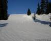
Entering the route and start getting toward the lake Maricheika. Then - right effort and time - right from the bus road is priming, which is the start of the route. After about 1,5 km begins a sharp rise in the north-north-east, which Barred access to the fence that protects cows from rural mountain adventures. In about 2,5-4 hours, you climb from an elevation of 900 m to 1500 m. Heavy lifting ends of the meadows, where there is water and you can even buy vurda, Budz and cheese, and another 1,5-2 km - o'clock 17-18 will be in place. For B & better not to stop once the lake and 100 meters to go ahead and turn left. There you will find many equipped with parking, and a little more - a great source.
Extra day. Werchowyna. East Capital Gutsulschiny is 25 kilometers from Vorohty, where the famous Carpathian odnokoliyka. Getting to Verhoviny can only be by car, or at foot, naturally. It seems that the lack of railroads helped to save Verhovine something pristine. You almost can not feel the devastating impact of civilization and not even a hint of nervousness and haste.
Orthodox Church in Verhovine. If you do not pay attention to the amazing clarity around highways, the first thing that catches your eye - a large number lisopylok.Derevo is still the basis of life: logs, timbers and boards used for any construction. Since trees were made and do almost all - furniture, furnishings, musical instruments, looms, bicycle frames ...
The bridge over the Black Cheremosh. Closed on all sides by mountains quiet valley living life fully autonomous in its parallel time. In the main square to see the stall of the Soviet "3-kopiychanoyi" soda water, some distance - strong hanging bridge over a fast and noisy black Cheremosh. Step into a courtyard where you can quench your thirst with pure flowing springs, meet lonely stray cows and just sleep under any tree.
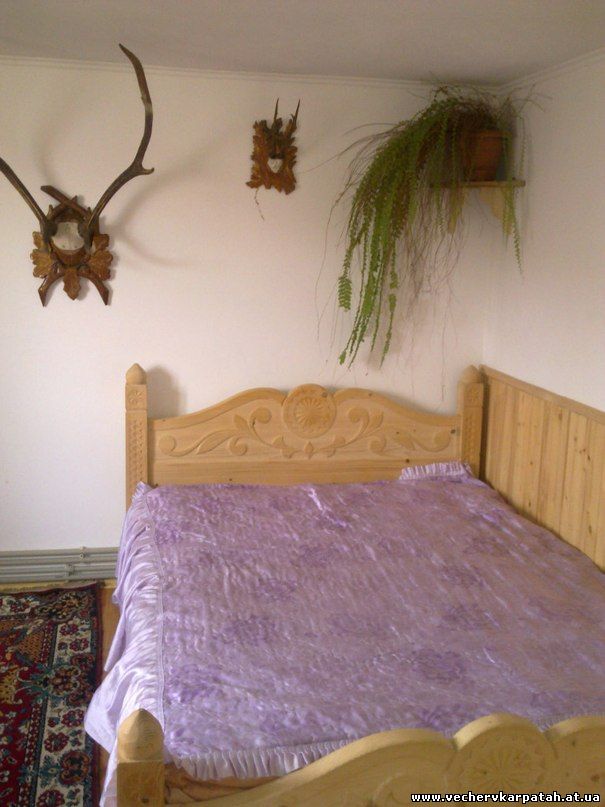
Some people compare his Verhoviny settlement from distant India. From the tourist point of view Verkhovyna - a relatively inexpensive Carpathian resort - per night we paid ~ 50 USD, $ 6 per person. This could come in summer for hiking radial incursion, but can - in winter: there are 2 amateur ski pidyomnyka.Okremyy interest museums - private museum gutsulskogo and musical instruments Roman Kumlika and Sergei Parajanov museum dedicated to his kinostrichtsi Shadows of Forgotten Ancestors. "
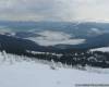
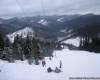
Day 2. Oz. Maricheika, 1510 - Pip Ivan, 2022 - d. Brebeneskul, 2032 - Lake. Brebeneskul, 1801. Maricheika - is located in village large enough (~ 1 ha), clear, shallow (~ 0.8 m) glacial lake shores pohodzhennya.Yoho covered with thickets and sedge meadows partly subalpiskimi. This combination of vegetation and water creates a wonderful atmosphere of security, but has sufficient height is evident. Cold rainy night here you will freeze at least at the spine. Morning with the release of better not be late, because today's move - one of the most vysnazhlyvyh.Pershu undercarriage northeast is up to the mountain Pip Ivan, where the ruins of the Polish Astronomical Observatory. Walking up to a height of 1800 meters, you leave the right path to the mountains and canyon eared stone, which begins descent to the village Dzembronya (Berestechko), cross the border of the forest and begin its journey on the open wind ranges and valleys.
The lake is surrounded by dense Maricheika fir forest. Having walked the path length 1,5-2,5 hours, you come closer to the ruins of the observatory "white elephant" that Poles built in June 1938, just months before the next chapter of their country. For some time observatory became the second biggest in Europe (after the French in the Pyrenees), but then finds himself in the hands of Soviet, Hungarian, and then Soviet authorities, fell into decay, having worked as a research institution only 3 years. Review of the Observatory and a snack should be conducted with the understanding that the way the rest of today will take time 3-4,5 hours, depending on physical readiness group and the decision of the head of the Traverse or rise to the top of Menchul and Brebeneskul.
The ruins of the Polish observatory on the Pip Ivan attract tourists from different European countries. With the release of the spine orienteering task even in very thick fog greatly simplified. Zbyvshys of the way, you only return to the highest place and correctly (visually or by using maps and compass) to determine the direction ruhu.Dodatkovoyu help along the route will be placed on the major peaks are numbered signs and pillar. Montenegrin array, being the highest ridge dividing the region has long been the overseas countries: Poland located in the east, west - Austria-Hungary and later Czechoslovakia. If you zib'yetesya from the path of descent or rise in the forest, people will go to another method. One needs to trickle (not difficult to do so) and go down the stream - the day you go out to the road or village.
Long time Montenegrin Mountains shared by different countries. Moving north-east to the right and left nameless peak and another path toward the mountains and canyon eared stone, you will walk slowly and Menchul Dzembronya mountains, and - second-tallest peak of Ukraine - Brebeneskul. From the main trail on the ridge to the lake are two tracks - starts on the gentle south-eastern mountain meadow Brebeneskul - where the trail passes traversnoyu and the second - nearly vertical - a few tens of meters to turn to mountain-Hutyn Tomnatyk. Veer off-road is possible, but not effective in terms of strength and opportunity costs of injuries.
Day 3. Oz. Brebeneskul, 1801-p. Turkul, 1933-p. Hoverla, 2061 - jumper Hoverla-Petros. Preparing for a hike on the Montenegrin ridge should be aware that the above is almost no acquaintances in other parts of the problems with drinking water. Uncharted streams and lakes can be found here at every turn. And you almost can not count on firewood. Although you can find thickets of dwarf pines, use them for cooking should not be. The abundance of dry firewood you will not find, and for the destruction of the vegetation of the reserve threatens at least B & shtraf.Hocha would you plan to stay at the spine, need to bring gas.
Descent to the lake on the south side Brebeneskul other tops Ukraine. Night at the beautiful mountain lake, where you can swim well (depth is 2,8 m) will be cool. Most amateur groups here appear at the end of June to early September and if you plan to hike to the beginning - mid-summer, almost certainly you will pass it under suspension of fog and rain, which does not contribute to warming. A little later - in August-September we can catch fine days, but in any case need to know that rain and fog phenomenon is long and regular. Apart from the usual travel gear (waterproof jacket, trousers and high trekking boots) to protect it from fog and rain should bring a waterproof cloak-poncho that can be immediately cover herself, and backpack, and leggings to cover the top of the shoe. Before leaving on the route should get weather forecasts for 10-14 days and inform the group of rules of behavior during thunderstorms.
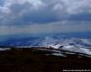
Hoverla often greets travelers rain and fog. The distance that you have to overcome today compared to yesterday, but much less vertical drop will move more freely pace. Back on the ridge, you come almost immediately mount Ribs and exit through 1-1,5 hours before getting to the mountain Turkul. Here you will see a wide trail that goes down to the east - toward Lake Nesamovyte where a 2-3-hour descent into the tourist Zarosyak (night, 80 or USD $ 10), and a little further - to the left track to the west, which in 3 - 4:00 lead you to the famous village Hoverlyanske Dam and meadows where Rachel goes on the bus (the latter is estimated at 17:00). This fork can be used as an emergency route from the east, and the lawn near the lake as a place Nesamovyte more additional dnyuvannya.
Rangers are on-Petros peremychtsi Hoverla not refuse a good brandy. Moving further along the ridge, you walk over the mountains 2,5-3 hours Turkul Dantsizh, Pozhyzhevska, Breskul and will go to Hoverlu.Spusk to peremychtsi Hoverla-Petros, where you can naprosytysya overnight to wardens, which you must sell tickets reserve, only takes 1-1,5 hours. If desired, you can stop at any of the jumpers or equipped parking pass so the foot of Petros. As the traffic you must meet several sources of drinking water.
Day 4. Jumper Hoverla-Petros - Petros G., 2022 - City Sheshul, 1728 - Poloniny Sheshul. Another early exit and a sharp rise in Petros will not be intimidating. Despite the fact that for 1-1,5 hours you have to dial the 400 meters height, revitalized and significantly lighter backpacks will be have to Petros to 11-12 PM. In fact here is the tricky part ends and the route can afford to take a photo for memory against neighboring Goverly.
Petros With stunning views of the nearby Goverlu. Petros C to the west is very smooth and pleasant path toward Skopeska meadows where you will through 1-1,5 hours after the start of descent. Having reached the crossroads of several paths, you'll find a convenient table, where to dine and to determine the place of future night.
Stay on top of the ridge during a thunderstorm is dangerous. The consequences of lightning. You can head west and spend the night back in the mountains - near turpryyutu "Menchul" to tomorrow afternoon or late morning, down on the highway near the village Kvasy. The same option is suitable for those wishing to continue the route on spine Svydovets. If you want to save time tomorrow to catch up to Frankivsk, it makes sense to go down to the most Kvasov where you can taste the water from mineral springs, and spend the night near the village.
At an altitude of 1500 meters and below it is possible to count on good wood. The third option to continue the route - down south in the valley of the river Tisza White, with easy bus to go to Rahiv.Tak you add to hike overnight in the mountains and south of slow walks through the woods. In this case you need to overcome Sheshul mountain and find sources on the southern side. You are easily able to find firewood and, if necessary vidihritysya.
Day 5. Polonyna Sheshul - Vydrychka - Rachel. Slow descent from the mountain and Sheshul tour-bus Vydrychka-Rahim will allow you closer to the afternoon to be in the western capital Gutsulschiny. This city is very different from the calm, unhurried?? Verhoviny and feminine. There is much more influenced Western civilization, and the surrounding mountain landscape, named Hutsul Alps, a bit like Austria, the possession of which were distributed here hundreds of years ago.
Orthodox Church in Rahove. The city felt very proud of the free spirit gutsulskih Highlanders, who strongly want to emphasize their nationality. It is in Rahove you can taste the true sheep (not the cow as Verhovine) cheese, which is very different from that sold in our grocery stores. Gutsulskaya cheese crisp and salty. Even the local market sold Budz - smoked cheese, in which the crust as bread - thick and brown, sweet and tender vurda, like soft cheese.
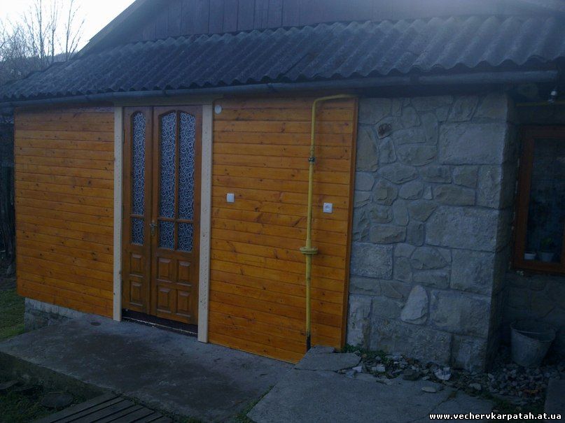
Gutsulskie Alps great in any season. Rahove can stop in one of several private hotels in town. We were lucky to live in a modern ethno-Hotel Smerekova House "(~ 80-120 USD, $ 10-15), which is located right near the market. Here, as in Verhovine can come in summer for hiking and radial veloputeshestviy as possible in winter, many rides to ride right out Bukovel Rahova. On the other attractions in the area Rakhiv a museum of mountain ecology in which by and large you can not go and ceiling, which indicates the exact geographical center of Europe.